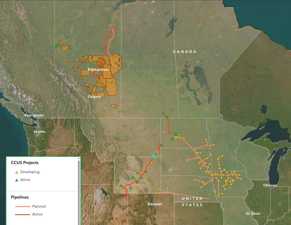
CCUS Projects in the PCOR Partnership Region
The commercial development of carbon, capture, utilization, and storage (CCUS) is already underway in the Plains CO2 Reduction (PCOR) Partnership region. The commercial landscape is dominated by the number of CCUS projects that store CO2 concurrently with the production of oil during CO2 enhanced oil recovery (CO2 EOR), i.e., associated storage. The remainder of the commercial CCUS activity in the United States is focused on the dedicated storage of CO2—the injection of CO2 into geologic formations specifically for the purpose of long-term storage. Commercial CCUS activity in Canada roughly parallels that of the United States, with CO2 coming from various industrial sources being stored using a combination of associated and dedicated CO2 storage.
CarbonSAFE Projects in the U.S.
The U.S. Department of Energy (DOE) Carbon Storage Assurance Facility Enterprise, or CarbonSAFE Initiative, began in 2016 to address the key gaps on the critical path towards CCUS deployment. Building upon the knowledge and experience of the Regional Carbon Sequestration Partnerships, like the PCOR Partnership, this initiative is performing identification and detailed characterization of geologic storage sites. The vision of CarbonSAFE is to understand the development of a CCUS storage complex from the feasibility study until the point of injection through the following phases of project progress: Integrated Carbon Capture and Storage Pre-Feasibility (Phase I), Storage Complex Feasibility (Phase II), Site Characterization and Permitting (Phase III), and Construction (Phase IV).* Several projects have progressed through one or more phases.
*U.S. Department of Energy, National Energy Technology Laboratory, CarbonSAFE Initiative, www.netl.doe.gov/carbon-management/carbon-storage/carbonsafe (accessed July 2025).
These CCUS projects are plotted on an interactive map to bring key information right to your fingertips. Click the button below to access the map.
Interactive Map
In addition to sedimentary basins and nationwide CarbonSAFE projects, the web-based map includes several additional features found in the upper-right corner of the map on the CCUS Projects tab, including:
CCUS layers
CCUS Projects
Pipelines
Wyoming Pipeline Corridor Initiative
Canadian Carbon Sequestration Agreement Zones
Land designation layers
National Parks of Canada
Indigenous Lands of Canada
Federal American Indian Reservations
Federal Land (United States)
Geology Layers
Williston Basin extent
Basal Cambrian thickness
Broom Creek thickness
Inyan Kara thickness
Sedimentary basins
Storage potential in deep saline formations
Measure tool
Check the distance between points on the map
Interactive Map Video Tutorial
Click play on the video to the right to learn about navigating the interactive map.